Flood risk in agricultural landscapes is often the result of decades of land use change. In the Evenlode river basin in southern England, a headwater tributary of the River Thames, river straightening, sedimentation in the river, soil compaction, and increasing built surfaces have reduced the land’s ability to absorb water. As a result, water runoff moves more quickly through the landscape, increasing flood risk on downstream communities. In 2007, a major storm flooded homes in one of the villages.
A different approach has been tested in the Littlestock Brook sub-catchment (16 km²), a smaller part of the Evenlode river catchment: working with natural processes to slow down water flow and temporarily store water across the landscape. This approach is known in the UK as natural flood management (NFM).
A landscape-scale experiment
A range of natural flood management measures have been implemented across the Littlestock Brook sub-catchment, to slow water flow and retain water across the landscape. These include:
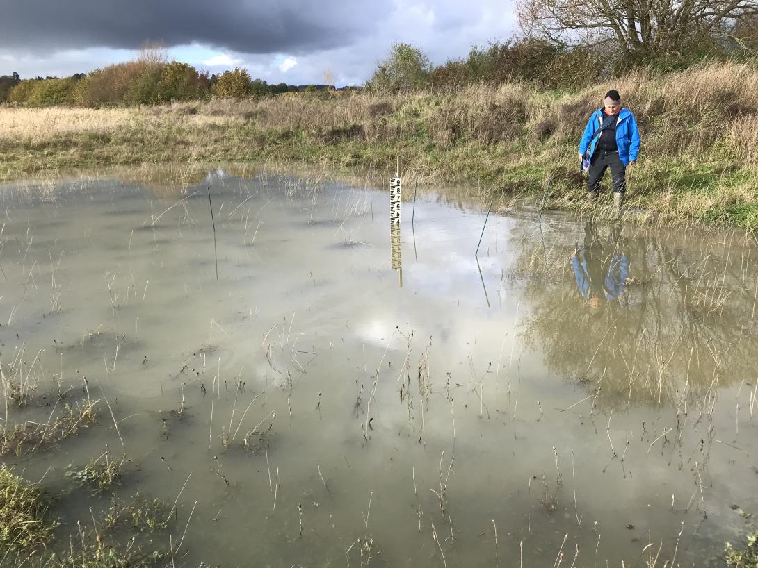
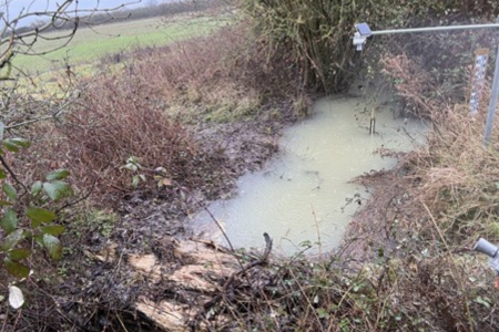
- Field corner bunds and ponds to temporarily store water.
- Woody “leaky dams” that slow down stream flow and connect to floodplain to store floodwater.
- Riparian woodland planting to slow the flow and carbon storage.
Rather than relying on a single intervention, the idea is to test how multiple small measures interact across the catchment.

Monitoring nature in action
To understand how these measures work together, researchers monitor the system at multiple scales: from individual fields to the whole catchment, using a combination of low-cost and high-tech monitoring. Measurements include:
- Rainfall, water levels in bunds, river and ponds and stream flow;
- Soil moisture at different depths in arable and riparian woodland;
- Sediment and nutrient transport;
- Aquatic plants and invertebrates.
This combination of long-term data and new monitoring technologies allows scientists to assess both immediate and long-term impacts.
Encouraging early results in term of flood risks reduction
Natural flood management measures appear to:
- Reduce and delay flood peaks, during low to extreme events.
- Lower downstream flood risk. Notably, a storm in 2024 similar to the one that caused flooding in 2007 did not lead to flooding in the village.
- Enhance biodiversity, as ponds and bunds have evolved into valuable habitats.
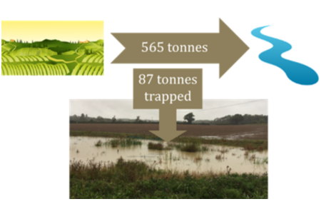
Interestingly, measures originally designed to trap sediment have developed additional benefits. Bunds and ponds, initially intended to capture eroded soil for reuse on farm fields (see picture below), have been colonised by vegetation and now provide habitats for a wide range of insects and other species. This shows how nature can amplify the benefits of these interventions.
Challenges and lessons learned
Results are not always immediate or uniform. For example, some farmers expected reduced waterlogging in certain fields, but this has not yet been clearly observed, possibly due to unusually wet conditions in recent years.
There are also important questions around long-term maintenance and funding. Some measures require farmers to leave parts of their land uncultivated, which can reduce income. While financial support currently helps offset this, long-term funding remains uncertain.
Maintenance is another key challenge. Leaky dams, ponds and bunds gradually deteriorate or fill with sediment over time and need restoration or replacement. In the Evenlode study, monitored leaky dams remained effective for around 7–8 years, and may continue to function for a few more years, but ongoing maintenance funding is not guaranteed. This highlights the need to include long-term monitoring, maintenance and periodic evaluation of effectiveness within future funding schemes.
The Evenlode case study shows that natural flood management can be effective, especially when measures are combined across a landscape. It also highlights that successful flood management depends on adapting to local conditions and working closely with farmers and communities to balance benefits and trade-offs.