In October 2025, as part of the SpongeScapes project, researchers from the Slovenian Environment Agency (ARSO) conducted a field visit to the Gradaščica catchment near Ljubljana, Slovenia, to collect essential data for the calibration of their hydrological model. This work will help improve understanding of how forest cover influences rainfall runoff and the catchment’s capacity to retain water — key to managing both floods and droughts.
Understanding the Landscape
The Gradaščica catchment lies in a hilly pre-alpine region, with elevations ranging from 300 to 1,000 metres above sea level. Around 70% of the area is forested, mainly with mixed and broad-leaved forests that play a crucial role in local water regulation. However, the catchment also faces challenges: its torrential rivers can cause downstream flood risks, especially for the city of Ljubljana.
Gathering the Data That Makes Models Work
During the visit, ARSO teams inspected three hydrological stations — Gradaščica Bokalce, Gradaščica Dvor, and Razori Šujica — where they performed control measurements of water level and temperature and assessed the surrounding riverbeds.
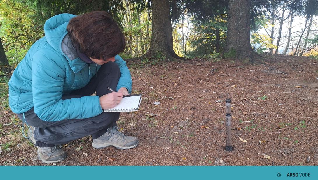
They also carried out infiltration tests at three locations (near Pristava pri Polhovem Gradcu, Pasja ravan, and Brezje pri Dobrovi) across different soil types, including limestone, dolomite, and clay soils. These data reveal how quickly water can soak into the ground, a critical factor for understanding how much water is retained or lost during rainfall.
Additionally, the team examined land cover and vegetation, since forests affect evapotranspiration and soil moisture — both important parameters for modelling natural water retention.
Calibrating the Model: Linking Fieldwork and Modelling
The fieldwork results will be used to calibrate the Wflow hydrological model. In simple terms, calibration means adjusting model parameters until the simulated outputs closely match real-world measurements. A well-calibrated model ensures that scientists can accurately predict how rainfall translates into runoff, infiltration, and storage — and how changes in land cover, like forest density, may affect these dynamics.
By combining on-the-ground measurements with advanced digital simulations, SpongeScapes researchers can better evaluate the “sponge function” of forest landscapes — how effectively they absorb, store, and slowly release water.
These efforts directly support the project’s broader mission: to understand and enhance Europe’s natural water retention capacity as a way to build resilience to floods, droughts, and other climate extremes.
See also
This fieldwork also connects to the recent SpongeScapes webinar on “Evaluating sponge functioning at landscape scale – The role of hydrological modelling”, held on 16 October 2025. You can watch the replay and read the presentations on our website here: https://www.spongescapes.eu/sponge-academy